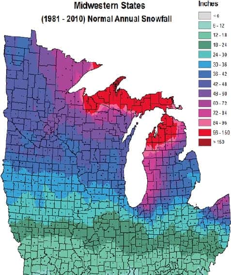
There is plenty of lake effect snow that falls each year in the Upper Peninsula of Michigan. Many times it is snowing like crazy, but the snow isn’t showing up on weather radar. Why does that happen?
Lake effect snow clouds are relatively low in the atmosphere compared to rain and especially thunderstorms. Lake effect snow cloud tops are usually no higher than 10,000 feet. Compare this to a thunderstorm that can be a tall as 50,000 feet.

Weather radar starts out as a signal transmitted from the radar dome near the ground. The radar beam is shot out of the radar at a slight upward angle. This has to happen so the beam can radiate out away from the dome and so the return signals do not hit the ground at the radar site. If that happened there would be no radar image as you are used to seeing.
As the radar beam travels up and out at an angle, the radar beam travels higher in the atmosphere. By the time the radar beam is 50 miles from the radar site, the radar beam is 5,000 feet up in the air. At 90 miles out the radar beam is 10,000 feet high.

The low nature of lake effect snow means the weather radar beam can shoot right over the top of the lake effect snow and not “see it.” That is why you will often look out the window in the U.P. of Michigan and it is snowing hard. Then you look at a radar image, and it doesn’t show snow at your location. Snow chasers will watch the radar and never see the snow on the screen but they are surprised to learn how much fresh snow actually did fall.

The radar stations that cover the western U.P of Michigan are located at Marquette, Michigan; Duluth, Minnesota and Green Bay, Wisconsin. Take a location like Twin Lakes, Michigan. It is about 70 miles from the Marquette radar and even further from the Duluth (or Green Bay) radar. On the radar screen it can look like no lake effect snow is falling anywhere from Ironwood to Copper Harbor, but it can actually be snowing HEAVILY in this area. This is because each of the radar beams, from Marquette to Duluth and Green Bay, would be well over 5,000 feet high and shooting right over the snow, hence no radar image of the snow that is falling.
For these reasons it is always a good idea to monitor daily snowfall reports and maps for a better grasp of actual snowfall, and not rely on radar observation when it comes to lake effect snowfall.

